Area Plan Name Index Area Photographs Main Menu

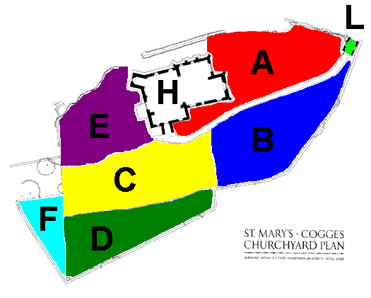
Click in any of the coloured areas of the map for a detailed view of that area.

The Churchyard area is 0.8 acre, bounded on the east, south, and south-west by a dry stone wall.
The wall to the east, and approximately half of the wall to the south is the property of the adjoining Cogges Farm Museum.
Area Map
MI Plan - Area A MI Plan - Area B MI Plan - Area C MI Plan - Area D MI Plan - Area E MI Plan - Area F MI Plan - Area H - Church MI Plan - Area L - Lych Gate


The Parish Church of St. Mary, Cogges, Oxfordshire. Copyright © St. Mary's Church Cogges Parochial Church Council, 2005
Updated 10th February 2005 Feedback